 Hub JACQU · Pexels License
Namibia
“The oldest desert on earth, and roads you can drive for an hour without meeting anyone.”
Namibia is the second least densely populated country in the world and it feels like it. The Namib is the oldest desert on the planet, with dunes at Sossusvlei rising 300 metres above a white clay pan, and the Skeleton Coast runs north from it in fog and shipwrecks. Etosha's salt pan draws game to waterholes in numbers that make it one of the easiest places in Africa to watch wildlife.
What makes it exceptional for travellers is that you can do it yourself. The gravel roads are well maintained, the distances are enormous but empty, and a two-week self-drive with a rooftop tent is the standard trip — no guide, no convoy, just fuel, water and a route. Damaraland has desert-adapted elephants and rhino, and the Fish River Canyon in the south is the second largest in the world.
Highlights
Sossusvlei and Deadvlei
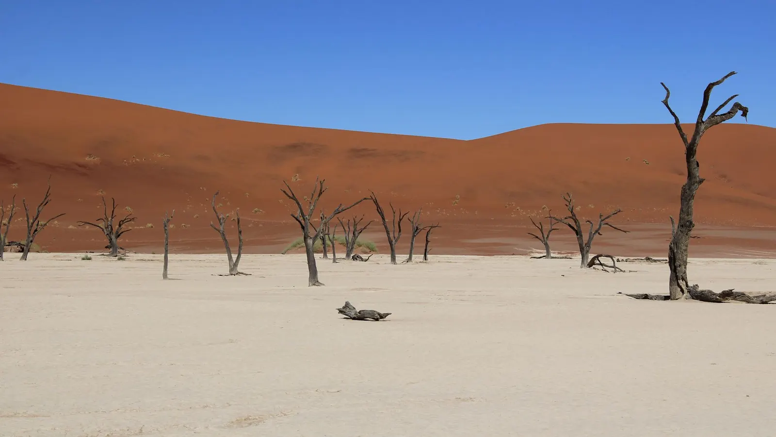
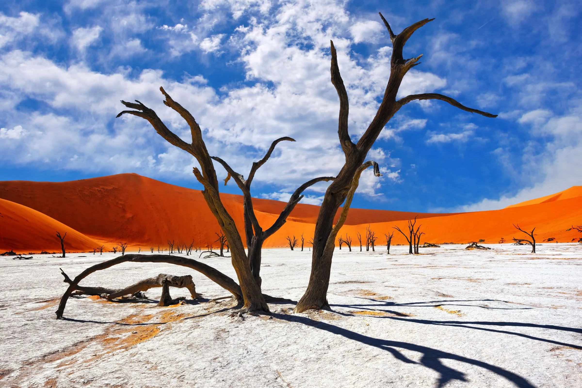
Red dunes up to 300 metres above a white clay pan with 900-year-old dead camelthorn trees on it. Enter the gate at sunrise — the light and the temperature both depend on it.
Etosha
A salt pan the size of a small country with waterholes around its edge. In the dry season the game comes to you, which makes it one of the easiest and most rewarding parks in Africa to self-drive.
Damaraland and the Skeleton Coast
Desert-adapted elephant and rhino, the Twyfelfontein rock engravings, and a fog coast of shipwrecks and seal colonies running north to the Angolan border.
Fish River Canyon
The second-largest canyon in the world, 160 kilometres long, with a five-day hiking route along the floor that runs from May to September and requires a medical certificate.
Entry requirements for Namibia
Checking your passport…
We don't hold entry details for this passport group yet.
Before you fly
The detail
- Passport validity
- Most destinations want validity beyond your stay, and some want six months. Check yours against the return date.
- Onward travel
- Airlines may ask for a return or onward ticket at check-in.
- Health
- Malaria prophylaxis is recommended for the northern regions including Etosha and the Caprivi from November to June; the desert and the south are malaria-free. Hepatitis A and typhoid are standard. Yellow fever certificate required if arriving from an endemic country. Healthcare in Windhoek and Swakopmund is adequate; elsewhere it is very distant, so evacuation cover matters. Tap water is safe in towns.
- Money
- Namibian dollar, pegged one-to-one with the South African rand, and rand is accepted everywhere. Cards work in towns, lodges and fuel stations; carry cash for remote areas and craft stalls. ATMs are in towns only. Tipping is expected at lodges and for guides.
What changed
When to go
BestApr–Oct.
Green, mild and quiet before the season — an excellent month.
The band above each month is our editorial verdict - it weighs crowds, prices and access as well as weather. The line is average daily temperature, the bars are monthly rainfall. Select a month for the figures. Climate figures: ERA5 reanalysis via Open-Meteo, 2005–2024 normals.
What it costs
A day in Namibia
Comfortable · sample day
≈ $130
Line items are real prices we track. The daily budget is an editorial estimate for this level, not their sum.
Where this sits among 244 countries we have costed
Lodges rise from July to October, which is both the dry season and the European summer holiday, and the Christmas fortnight spikes again. April, May and November are noticeably cheaper for weather that is nearly as good. Park fees are low and fixed — unusual in southern Africa, and one reason Namibia is cheaper than a Kenyan or Tanzanian safari.
Updated Aug 2026 · Editorial synthesis — Namibia Wildlife Resorts tariffs, rental and lodge sampling, fuel prices (2025–2026) · confidence high
Excludes international flights - they depend on where you fly from.
Regions to know
5Windhoek & the centre
The capital, the Khomas highlands, and the private reserves and guest farms within a few hours of it.
The Namib & Sossusvlei
The dune sea, Deadvlei, Sesriem canyon and the desert-adapted wildlife of the NamibRand reserve.
Swakopmund & the Skeleton Coast
The German colonial coastal town, Walvis Bay's flamingos and seals, and the fog coast running north.
Damaraland & the northwest
Twyfelfontein's rock art, desert elephants and rhino, Spitzkoppe's granite, and Kaokoland beyond.
Etosha & the north
The salt pan and its waterholes, plus the Caprivi strip in the far northeast with rivers and a different ecosystem entirely.
Practical guide
Getting there
Windhoek Hosea Kutako (WDH) takes direct flights from Frankfurt and regional connections via Johannesburg, Cape Town and Addis Ababa. Land borders with South Africa, Botswana, Zambia and Angola are open; the Trans-Kalahari from Botswana is a common overland route.
Getting around
Self-drive is the whole point. Rentals with rooftop tents, dual batteries and recovery gear are a mature industry in Windhoek. Distances are long — Windhoek to Sossusvlei is five hours, to Etosha four and a half. Fly-in safaris serve the remote northwest. There is a limited bus network and almost no public transport to the parks.
Money & costs
Namibian dollar, pegged one-to-one with the South African rand, and rand is accepted everywhere. Cards work in towns, lodges and fuel stations; carry cash for remote areas and craft stalls. ATMs are in towns only. Tipping is expected at lodges and for guides.
Safety
Low crime outside Windhoek, where ordinary city precautions apply. The genuine risks are all on the road and in the emptiness: rollovers, breakdowns hundreds of kilometres from help, dehydration and getting lost. Wildlife is unfenced in much of the country. Carry a satellite communicator if you go beyond the main circuit, and always tell someone your route.
Health
Malaria prophylaxis is recommended for the northern regions including Etosha and the Caprivi from November to June; the desert and the south are malaria-free. Hepatitis A and typhoid are standard. Yellow fever certificate required if arriving from an endemic country. Healthcare in Windhoek and Swakopmund is adequate; elsewhere it is very distant, so evacuation cover matters. Tap water is safe in towns.
SIM & internet
MTC SIMs are cheap and coverage follows the main roads and towns. There are long stretches with nothing, particularly in Damaraland, Kaokoland and the far south. Lodge wifi is often satellite and slow. Download offline maps before leaving Windhoek.
Driving
Gravel is the defining hazard. The posted 100 km/h on gravel is a limit, not a target — 80 is the sensible maximum and every rental company will tell you so, because rollovers are what they see. Tyre damage is common; know how to change a wheel and check you have two spares on remote routes. Never drive at night.
Rules change - verify with an official source before you rent.
ExplWorld VerifiedNo verified partners here yet - all 6 country seats are open.
Become ExplWorld Verified →Itineraries through this country
From the Journal
Before you go
NamibiaFrequently asked questions
Do I need a 4WD?
For most of the standard route, no — the main gravel roads are fine in a 2WD sedan with good clearance, and Etosha and Sossusvlei are both accessible. A 4WD with a rooftop tent is what most people rent because it opens up Damaraland, Kaokoland and camping anywhere. If you plan to reach the Van Zyl's Pass or the far northwest, it is essential and you should not go alone.
How dangerous are the gravel roads?
They are the main risk of a Namibian trip. Rollovers on gravel are the most common serious accident here — caused by driving too fast, oversteering after a wobble, and single-vehicle loss of control. Keep to 80 km/h on gravel, slow right down for corrugations and sand, and do not drive at night, when kudu on the road are a genuine hazard.
How much water and fuel should I carry?
More than you think. Distances between fuel stations run to 300 kilometres in the north and west, and some are unmanned or out of stock. Fill at every opportunity, carry at least five litres of water per person per day plus a reserve, and tell your accommodation your route. Mobile coverage disappears for long stretches.