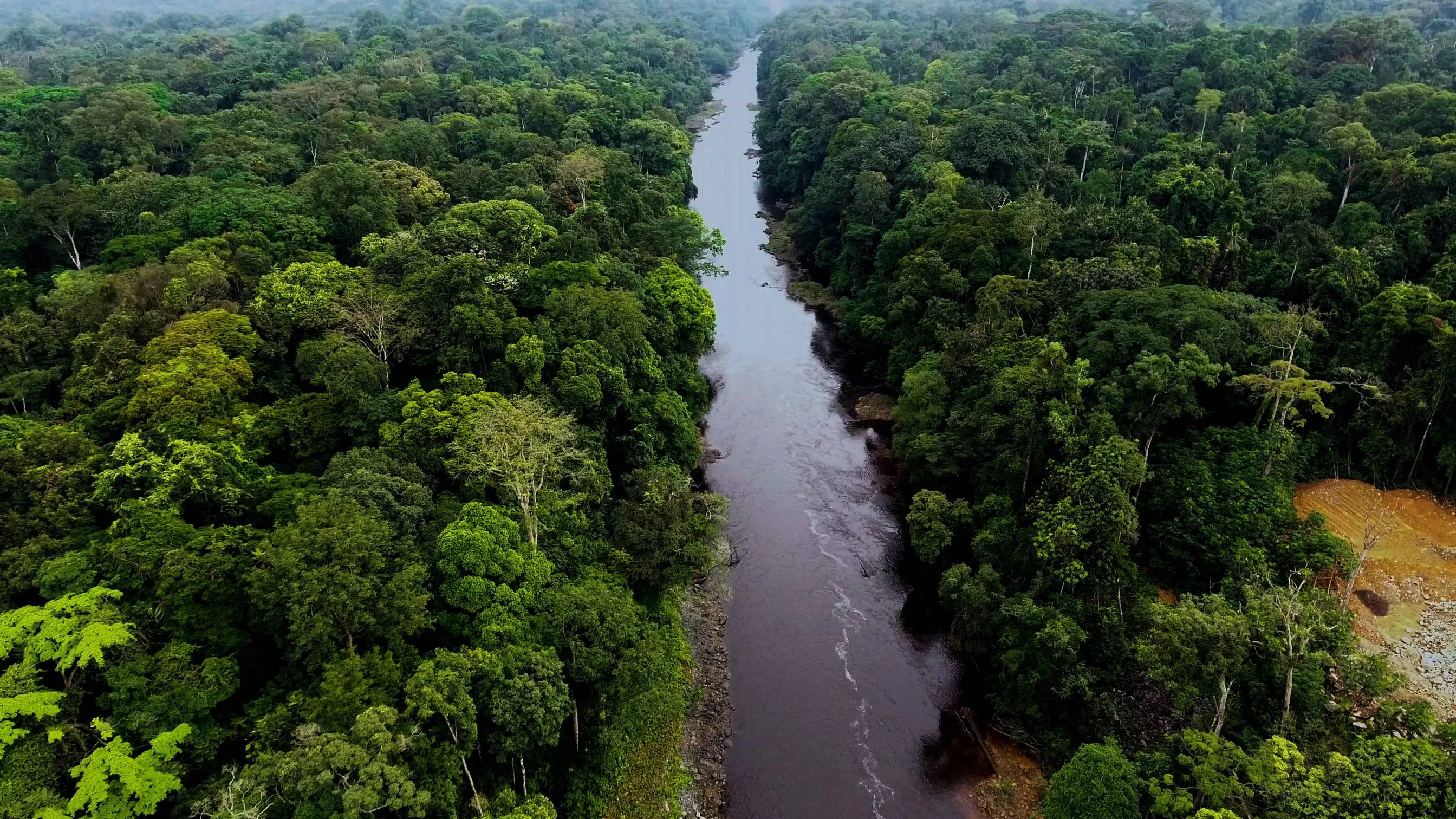
A volcanic island with seven kinds of monkey on it and a road to the top of a 3,011-metre cone, then the highland village where the island's conservation programme is run from, the turtle beaches on the south coast, and a flight across the Gulf to the mainland — Monte Alén's forest, the empty motorways built with oil money, and the capital city being constructed in the trees at Djibloho.
Malabo
The old town is small, Spanish and walkable, and it was called Santa Isabel until 1973. The cathedral on Plaza de la Independencia is neo-Gothic with twin towers and was begun in 1897 and finished in 1916; around it are the shuttered wooden verandas of a colonial port that stopped growing when the cocoa did, and immediately behind them the concrete of a city that grew again, very fast, after 1996. Walk the seafront and the Paseo Marítimo, look at the market at Semu, and read the photography note in the practical section before you take your phone out anywhere near the port, the airport or the presidential palace. This is the part of the trip most likely to go wrong, and it goes wrong over a picture.
Up Pico Basilé
The island is one volcano with a town at the bottom of it, and a road goes to the summit. It climbs in switchbacks out of Malabo through farms, then cocoa, then closed forest, then the stunted stuff near the top, and there is a white statue of the Virgen de Bisila beside it partway up where people stop. The military installations and masts at the summit are the reason the barrier at the base exists: permission is needed, it is arranged through your hotel or a Malabo agency rather than at the gate, and it is refused often enough that this should not be the only reason you came. If it is refused, the middle of the road is still the best forest access on the island from a vehicle. Take a fleece — 3,011 metres on the equator is cold in cloud, and the summit is in cloud most days.
Across to Luba
South-west across the island to the second town, a small port on the west coast with a deep-water freeport built beside it for the offshore industry. The old part is a handful of streets and a church above a bay. Arena Blanca, a few kilometres north, is the beach everyone from Malabo drives to at the weekend, and it is worth an afternoon for the swimming and for watching what an Equatoguinean weekend actually looks like. From here south the roads get slower and the villages get smaller.
Into the highlands at Moka
Up off the coast into the southern highlands, and the temperature drops as you climb — Moka sits around 1,400 metres in open grassland with forest below it on every side, and it is the coldest place in the country. This is Bubi country, and the village is the base for the Bioko Biodiversity Protection Program, the joint Drexel University and Universidad Nacional de Guinea Ecuatorial operation that has been counting carcasses in Malabo market and monitoring the southern beaches for close to thirty years. Arrange your walking days and your reserve permission through them; there is no other functioning way to do it. Evening here is woodsmoke and cloud coming up the valley.
Lago Biao and the caldera rim
A full day on foot. Lago Biao lies in its own crater below the village and the descent to it is steep, wet and slippery, through forest the whole way — three or four hours down and rather more back, with a guide from the village, and no view at all until you are on the water. The other option from Moka is the walk out to the rim above the Gran Caldera de Luba, the enormous collapsed crater filling the southern end of the island, which was written into the protected area network by the law of 2000 and has no road, no gate and no infrastructure in it. Going down into the caldera itself is a multi-day expedition with porters, arranged well in advance, and is not part of this route.
South to Ureca
Down off the highlands to the south coast, where the mountain meets the Atlantic with almost nothing in between. Ureca is a village of a few hundred people and one of the wettest inhabited places in Africa; the beaches on either side of it are where leatherback, green, olive ridley and hawksbill turtles come ashore, with the leatherback season running roughly from November into February. Nights are spent walking the sand with the monitoring team, who tag and count rather than perform. Confirm the state of the southern track in Moka before you commit to it — it was cut in the 2010s, it is laterite, and heavy rain closes it; the fallback is the old footpath, which is a long day's walk with your bag.
Back north to Malabo
A last hour on the beach at first light, when the tracks from the night are still legible in the sand and the team walks them to log what came up, then the long way back: up to Moka, across to the east coast at Riaba, and north to the capital under the flank of the volcano. Riaba is a fishing town with a decayed colonial waterfront and a good reason to stop for an hour. Get to Malabo in daylight, and repack — the mainland half of the trip has different rules, more checkpoints and much better roads.
Over the Gulf to Bata
The flight is about thirty-five minutes and Ceiba flies it several times a day; read the air-safety note in the practical section before you book, because it will decide the question for some employers. Bata is the largest city in the country and it is on the continent, which makes it a different place from Malabo entirely — bigger, hotter, Fang-speaking, and rebuilt along a seafront promenade with oil revenue in the 2000s. The Torre de la Libertad stands at the end of it. Spend the afternoon in the central market, which is the best-stocked in the country, and eat fish.
Inland to Monte Alén
East out of Bata on the highway to Niefang — wide, new, smooth and almost entirely empty, which is the first thing about the mainland that surprises people — then off it on a laterite spur that climbs into the hills. Monte Alén is the largest national park in the country, some two thousand square kilometres of Río Muni rainforest running towards the Gabonese border, and it holds forest elephant, gorilla, chimpanzee and mandrill. The visitor infrastructure built here with European funding in the 1990s has largely gone back to the forest. Arrange the visit and the guides beforehand through INDEFOR-AP or an operator in Bata; there is no gate to turn up at.
A day in the forest
Out early with the guides. Be honest with yourself about what this is: primary equatorial forest with high canopy and low visibility, where the large mammals are present, hunted, and extremely wary of people, and where a good day is tracks, dung, nests, a hornbill going over and a troop of monkeys heard and not seen. The walking is hot, wet and steep, leeches are a fact, and the reward is the forest itself rather than a list. The circuits from the village run to the Lago Atok basin and along the ridges; the guides will pitch a distance to you and it is worth taking the longer one.
Djibloho and Mongomo
East across the interior on the highway, and the strangest day of the route. At Djibloho, in forest on the Wele river, a capital city is being built from nothing — Ciudad de la Paz, begun in the early 2010s to move the seat of government off an island and into the middle of the country, with boulevards, ministries, a university and a golf course laid out on a grid that the trees are still standing in. Whether it ever fills is the open question, and Equatoguineans argue about it. An hour further east at Mongomo, on the Gabonese border, the Basílica de la Inmaculada Concepción was consecrated in 2011 and is one of the largest churches in Africa, in a town of a few tens of thousands. Photograph neither carelessly — and understand where you are: this is the frontier belt, with Gabon a few kilometres east of Mongomo and the Cameroonian border north of Ebebiyín, so the checkpoints are closer together than anywhere else on the route and a camera is least welcome here of anywhere in the country.
The highway back
West on the Bata–Mongomo road, which is the best long tarmac in the country and about 250 kilometres of it: four and a half hours with the checkpoints, three and a half without, through Añisoc and Niefang with forest on both sides and very little else. The country you cross is the reason the capital is being moved into it. Back in Bata by early afternoon for the flight to Malabo, which connects with most of the evening departures out of the country — but if yours leaves in the morning, sleep in Malabo rather than trusting a same-day connection through a single domestic route.
Good to know
The visa is the hardest part of the trip and it should be started weeks rather than days ahead. Most nationalities need one arranged in advance from an embassy, the network of them is thin, and the usual bundle is a letter of invitation or a confirmed hotel booking, a yellow fever certificate, proof of funds and sometimes a police certificate. United States passport holders are the long-standing exception and have been able to enter without a visa for stays of up to ninety days; nobody should assume that extends to them by analogy. An electronic application system exists and accounts of whether it works are inconsistent enough that you should treat it as a bonus and not as a plan — have the embassy route running in parallel. A yellow fever certificate is required of all arrivals and it is genuinely checked at Malabo, so carry the card with the passport rather than in the bag. Malaria is the medical question that matters: falciparum, year-round, across the whole country including both cities. Bioko is the interesting exception, because the Bioko Island Malaria Elimination Project has run indoor residual spraying and net distribution across the island since 2004, funded largely by the oil companies working offshore, and infection rates in children have fallen a very long way from where they started. Fallen, not gone — take prophylaxis for the whole twelve days, island and mainland alike, and take the dengue precautions too, because the daytime mosquitoes are a separate problem. Photography is the rule that gets visitors into trouble here, and it is worth being blunt about. Do not photograph the airport, the ports, the presidential palace, military or police personnel, checkpoints, bridges or government buildings. People have been detained, phones have been searched and images deleted, and an apology afterwards is worth much less than not taking the picture. The formal photography permit that used to be required has been dropped, but officials at a roadside barrier do not always know that, and arguing the point with one is a poor use of an afternoon. Ask before photographing people, and put the phone away entirely when you are stopped. Drones are a different order of problem again — expect one to be confiscated at Malabo airport on the way in, and treat flying one anywhere in the country as the fastest available route to a cell. Checkpoints are frequent on both the island and the mainland: carry your passport at all times, keep paper photocopies separately, keep the vehicle documents accessible, and be unhurried and polite — most stops last two minutes. The currency is the Central African CFA franc, pegged to the euro at 655.957, which makes euros in cash the useful money and dollars an unnecessary extra conversion. ATMs exist in Malabo and Bata and fail often; cards work at a handful of Malabo hotels and essentially nowhere else; bring more euro cash than you think you need and change it at a bank rather than on a street. Prices are high, particularly in Malabo, where hotel rates were set by an oil boom and never came down. Spanish is the working language and you will need some — French and Portuguese are official as well, but Spanish is what is spoken in offices, shops and at checkpoints, alongside Fang on the mainland, Bubi on Bioko and Pichi in Malabo. Getting between the two halves of the country means flying: Ceiba Intercontinental runs Malabo–Bata several times daily in about thirty-five minutes. Note that carriers certified in Equatorial Guinea are on the European Union air safety list and banned from European airspace — that is a regulatory finding about safety oversight rather than a verdict on any particular aircraft, but it is the reason many employers and insurers will not permit staff to fly domestically here, and you should check your own travel insurance against it before booking. A passenger ferry between Malabo and Bata exists and runs irregularly; treat any sailing you find as a bonus. Independent travel is legal and possible and there is almost no tourism industry to support it — few hotels outside the two cities, no guiding network, no park gates selling tickets — so the practical arrangement is a vehicle hired with its driver and everything else booked before you arrive. For Moka, Ureca and anything in the Gran Caldera the fixed point is the Bioko Biodiversity Protection Program at the Moka Wildlife Center; for Monte Alén it is INDEFOR-AP, the national institute that administers the protected areas created under the 2000 law, or a Bata operator working with them. Season: Bioko is very wet and Ureca is one of the wettest inhabited places on the continent, so it will rain on you in any month. The driest window on the island is roughly December to February, which is also when the turtles are nesting on the southern beaches, and that is the window this route is written for; the mainland has a second drier spell around June to August. Finally, the roads are the opposite of what the region prepares you for. The mainland highways — Bata to Mongomo, Bata to Ebebiyín — are wide, new, well surfaced and almost empty, and they cover ground faster than anything comparable in Central Africa. It is the laterite spurs off them, and the southern half of Bioko, that eat the day.
Shorter or longer?
Add five or six days and fly out to Annobón, a volcanic island some 600 km south-west of Bata — far closer to São Tomé, 160 km away, than to any other part of Equatorial Guinea — with a crater lake in the middle of it and a Portuguese-based creole, Fa d'Ambô, that is spoken nowhere else. The flights are infrequent, they are cancelled, and there is no dependable way to guarantee being back on a given date — which is exactly why the island is what it is, and why you should only go with a genuinely open end to the trip.
Malabo, Pico Basilé, Luba, two nights at Moka for Lago Biao, and back. Keeps the volcano, the highlands and the monkeys, and drops the mainland, the domestic flight and most of the checkpoints along with them. It also drops Ureca, which is the part of the route hardest to reach and hardest to give up.