The north-east, which almost nobody who comes to India sees: the wettest hills on earth and their bridges grown from living roots, a river island losing itself to the Brahmaputra, the capital of a six-hundred-year kingdom that broke a Mughal fleet on the river, and the ridge above Kohima where the Japanese advance into India stopped.
Guwahati
The gateway everything in the north-east passes through, and worth a day rather than the airport transfer most people give it. Kamakhya on Nilachal Hill is one of the most important Shakta temples in India and is busy from dawn. In the evening the Brahmaputra is a kilometre and a half wide here and looks like an estuary.
Up into Meghalaya
A hundred kilometres and fifteen hundred metres up, out of the Assam plain into the Khasi hills. Shillong was the summer capital of colonial Assam and still has the church-and-pine look of it; the useful thing to do on arrival is arrange onward cars, because everything beyond here runs on shared vehicles that leave early.
Sohra
Still signposted as Cherrapunji. It holds the two rainfall records that matter — 9,300 mm in July 1861, and 26,461 mm in the twelve months ending that July — and nearby Mawsynram has the higher annual average. The gorges drop away south towards the Bangladesh plain, which is visible on a clear day and is where all that water comes from.
Nongriat
From Tyrna the path goes down about 3,000 steps to the double-decker root bridge — jingkieng jri, guided over decades from the aerial roots of Ficus elastica by Khasi villagers and still growing, which is why it gets stronger with age where a timber bridge would rot. India put them on its UNESCO tentative list in February 2022 and handed the full nomination dossier to the World Heritage Centre in January 2026, for the 2026–27 cycle. Sleep in the village if you can; the climb back out is the harder half.
The Umngot
East along the escarpment to Shnongpdeng, above Dawki. In winter the Umngot runs clear enough that boats appear to float on nothing, which is the photograph everyone has seen; in the rains it is brown and fast and the picture is not available. The Bangladesh border post at Dawki is a few kilometres downstream and the trade is stone.
Mawlynnong and back up
Mawlynnong sells itself as the cleanest village in Asia on the strength of a magazine citation and has become a coach stop; the single-span root bridge at Riwai, ten minutes away, is the better reason to be here. Then back up to Shillong for the night, because tomorrow is long.
Down to Kaziranga
A driving day: off the plateau, through Guwahati, then east along the south bank of the Brahmaputra — the park is on this side, so you never cross the river — with tea gardens on both sides of the road for the last two hours. Arrive in time to book tomorrow morning at the range office rather than through the lodge, which costs less and gets you an earlier slot.
Kaziranga
Two thirds of the world's greater one-horned rhinos live in this floodplain, and the 2022 census counted 2,613 of them here. Go into Bagori at first light and Agoratoli in the afternoon — different grassland, different animals. The park also holds one of the densest tiger populations anywhere, which you will not see, and wild water buffalo, which you will.
Onto the island
East to Jorhat, out to Nimati Ghat, and across on the government ferry with motorbikes, sacks of rice and a few cars lashed to the deck. Majuli measured about 1,250 square kilometres at the start of the twentieth century and 352 at the 2014 survey — the Brahmaputra takes several square kilometres in a bad year, and the whole island is an argument about what can be done about that.
The satras
Monasteries of the neo-Vaishnavite order Srimanta Sankardev founded in the sixteenth century — Auniati, Kamalabari, Dakhinpat — where the liturgy is dance and drum rather than sacrifice. At Samaguri the monks make the mukha, papier-mâché masks for the Raas performances, and will show you how if you turn up in the afternoon. Bicycles are the way to move around; the roads are flat and empty.
Sivasagar
Back over the water to the capital of the Ahom kingdom, which ruled Assam from 1228 until the British took it under the Treaty of Yandabo in 1826 and which beat the Mughals decisively on the river at Saraighat in 1671. The Rang Ghar, a brick pavilion of the 1740s built to watch buffalo fights from, and the Talatal Ghar with its underground floors, are what is left above ground.
Into Nagaland
South-west to Dimapur, then up the hill road to Kohima — 74 kilometres that take most of three hours. The permit has to be in hand before you start; see the notes. The change is abrupt: from Assamese and tea gardens to Naga hills, Baptist churches on every ridge and a state that has been dry on paper since 1989.
The tennis court
The Japanese advance into India stopped on this ridge between April and June 1944, at the deputy commissioner's bungalow, and the fighting ran across his tennis court at a range of a few metres. The court is marked out in concrete inside the war cemetery on Garrison Hill, and the epitaph at the bottom of it is the one everybody quotes. The state museum in town lays the Naga tribes out one at a time, district by district, rather than flattening them into a single costume.
Khonoma, and out
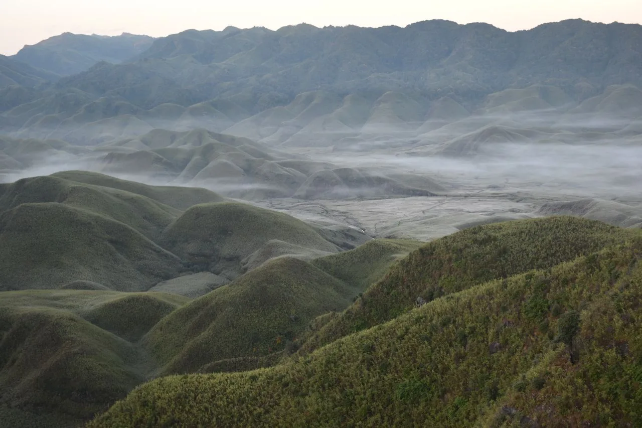
Twenty kilometres west, Khonoma held out against the British through 1879 and 1880 and was the last Angami village to come to terms. In 1998 it banned hunting across its own land and declared a tragopan sanctuary, which is a decision taken by a village rather than a state. Give it the morning and the terraced valley below it the early afternoon, then run back through Kohima and down the hill to Dimapur for the onward train or flight. The Dzükou valley does not fit into this day and should not be forced into it — the climb from Viswema, south-east of Kohima, is three or four hours up and about as long back, so it wants a day of its own; a fire there over the turn of 2020 into 2021 burned for the better part of a fortnight.
Good to know
Permits are the thing to get right, and the rules changed recently. Assam and Meghalaya need none. Nagaland does: Indian citizens who are not residents need an Inner Line Permit, applied for online at ilp.nagaland.gov.in — issuing moved online on 1 January 2025, and an offline counter was restored later that year for some categories after local objections — and it covers Dimapur too, which the state brought inside the line in December 2019 and which people still assume is exempt. Foreign nationals are in a different position again: on 17 December 2024 the Ministry of Home Affairs reimposed the Protected Area Regime on Nagaland, Manipur and Mizoram after fourteen years of relaxation, so a foreign passport now needs a Protected Area Permit arranged in advance rather than a visa alone, and citizens of Afghanistan, China and Pakistan, or anyone of Pakistani origin, need clearance from the ministry itself. This is a live policy that Nagaland's own government has asked to have reviewed, so confirm it before booking the last three days. Foreigners must also register with the Foreigners Registration Officer within 24 hours of arriving in the state. Season decides most of the rest: Kaziranga closes for the monsoon at the end of May — the 2026 season ran to 29 May — and reopens on 1 October, with the individual ranges coming back on line as the floodwater drops, so a summer version of this trip has no park in it. The same months put two to three metres of rain on Sohra, which makes the Nongriat descent genuinely dangerous and turns the Umngot opaque; November to March is when both work. Shared Sumos are the transport backbone and they leave when full, between about five and seven in the morning, with almost nothing running after early afternoon — book a seat the day before, and treat the last Majuli ferry, mid-afternoon, as a hard deadline. Nagaland has been under total liquor prohibition since 1989 and the Armed Forces (Special Powers) Act still applies in parts of the state, so expect checkpoints and carry the permit on your person. Manipur, immediately south, has been under recurrent ethnic violence since May 2023 with curfews and internet shutdowns; this route does not enter it and should not be extended into it without current advice — note that the Dzükou valley straddles the boundary, and the Viswema and Zakhama approaches stay on the Nagaland side. Cash matters more here than in the rest of India — ATMs are reliable in Guwahati, Shillong, Dimapur and Kohima and thin everywhere else, and Majuli in particular is a cash island.
Shorter or longer?
Add four or five days for the Ziro valley and the Apatani country north of the Brahmaputra. Arunachal Pradesh needs an Inner Line Permit for Indian citizens and a Protected Area Permit for foreigners in every case, both arranged before you travel, and the road up from North Lakhimpur is slow.
Guwahati, Shillong, Sohra, Nongriat, the Umngot and back. Keeps the root bridges and the gorges, drops Assam and Nagaland entirely, and removes every permit question from the trip.