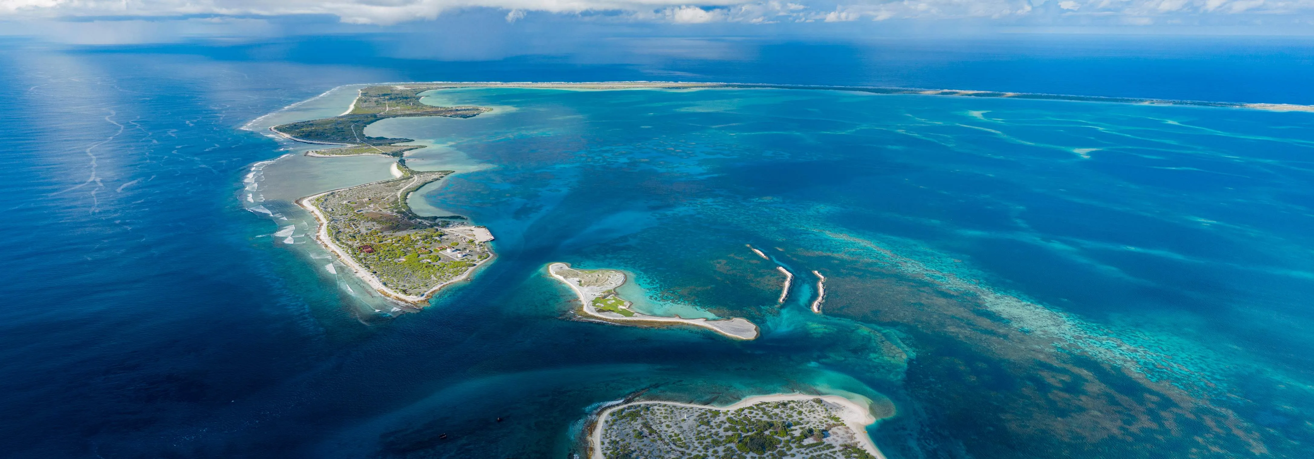
Seven days in the Gilbert Islands, flying in to Bonriki from Nadi or Brisbane and sleeping on South Tarawa, in a North Tarawa village and on Abaiang. The battlefield at Betio, the atoll where the road ends and the tide takes over, and one village that has already been moved. The Line Islands are 3,300 kilometres east with no dependable flight between them, so they are not in this route and the summary says so rather than pretending.
South Tarawa, end to end
One road runs about thirty-five kilometres from Betio in the west to Tanaea in the east along a strip of coral that is in places under a hundred metres wide, and roughly sixty thousand people live on it — half the country. Ride the shared minibuses the whole length on the first afternoon and the shape of the place explains itself: causeways where there used to be channels, seawalls of stacked coral rubble and old tyres, houses on the lagoon side and the ocean four minutes' walk away. Te Umanibong, the national museum at Bikenibeu, holds the collection in two rooms and keeps unreliable hours. At the eastern end, the water reserve over the Bonriki freshwater lens is the reason South Tarawa has a supply at all — a thin body of rain floating on seawater, over-drawn, and lived on by people who have nowhere else to build.
Betio
The island is a little over three kilometres long and nowhere much more than half a kilometre wide, and between 20 and 23 November 1943 about a thousand United States Marines and sailors were killed taking it, along with almost the entire Japanese garrison of some four and a half thousand men — around twelve hundred of them Korean labourers. Seventeen Japanese soldiers and a hundred and twenty-nine Koreans surrendered. The landing went wrong because the tide did not rise as planned and the landing craft grounded on the reef flat, leaving men to wade several hundred metres into machine-gun fire. The eight-inch guns still sit on their mounts at Temakin Point: Vickers guns, bought by Japan from Britain around 1905, and not, as the story is told everywhere, captured at Singapore. Bunkers and pillboxes are built into yards and used as storage. Landing-craft hulks show on the reef at low water. Near the port is the memorial to the twenty-two coastwatchers and civilians, most of them New Zealanders, beheaded here on 15 October 1942. The airstrip the whole operation was fought for is under the town.
Across the channel to North Tarawa
The causeway ends at Buota and so does the tarmac. A boat takes ten minutes across the channel to Abatao, and from there the atoll runs north for forty kilometres as a chain of islets with villages on them, no road, no mains power to speak of and no shop worth the name. This is the Kiribati that South Tarawa is not: babai pits dug down to the water table for swamp taro, copra drying on racks, canoes under the trees. Present yourself to the unimwaane, the village elders, when you arrive — it is expected, it takes ten minutes, and it is the difference between being a guest and being a nuisance. Bring rice, sugar, flour and fuel rather than money.
North to Buariki, on the tide
A long day up the atoll: boat along the lagoon side, then walking between islets across the flats at low water, which is why the tide table decides what time you leave rather than you. Naa and Buariki are at the northern tip and they are as far from the capital as it is possible to get on the same atoll. The last fighting of the 1943 battle happened here on 27 November, four days after Betio fell and over thirty kilometres from it, and almost nobody who visits the guns goes to look. The reef on the ocean side is intact in a way the capital's is not, and the swimming is on the lagoon.
Abaiang
Fifteen minutes in the air from Bonriki, three or four services a week, and a flight that is cancelled often enough that you should treat the date as provisional. Abaiang is the atoll immediately north of Tarawa and it is where Christianity entered the Gilberts: Hiram Bingham the younger, of the American Board, landed here in November 1857, stayed, and translated the Bible into Gilbertese, finishing in 1890. He did it under the protection of the uea, the high chief of Abaiang, whose authority at the time reached over Tarawa and Marakei as well. Taburao has the airstrip and the government station; the lagoon is broad, shallow and full of fish traps built of stone, some of which have been maintained by the same families for generations.
Tebunginako
The village that gets shown to visiting delegations, and the islanders are more precise about it than the delegations tend to be. Tebunginako moved inland because the sea came through: the old maneaba and the church now stand in water at the top of the tide, coconut stumps run out into the lagoon where the shoreline used to be, and the wells behind them went salt. Ask on the spot and you will be told two things, both of them true — that the sea has risen, and that a causeway built across a passage changed how water moves through this part of the lagoon, and that the two things happened to the same beach. It is worth an afternoon and worth the walk out to the ruins at low water, because this is what the sentence "a village had to be relocated" looks like when it is a real place with a name.
Back to Tarawa, and the day you keep spare
Fly back in the morning if the aircraft comes, and if it does not, this is the day the route was built to absorb — which is the only reason it is here. Assuming it comes: the Maneaba ni Maungatabu at Ambo is the parliament, built as a maneaba because that is the building this country makes decisions in, and the public gallery is open when the House sits. Otherwise Bairiki for the government offices and the stadium, the causeway at dusk, and the fish market. Then Bonriki, which is fifteen minutes from anywhere on the atoll and where the international departures leave at unsociable hours.
Good to know
Most nationalities — EU and EEA, UK, US, Canadian, Australian, New Zealand — enter visa-free for thirty days on arrival with a passport valid six months, an onward ticket and an address; a yellow fever certificate is asked for only if you are arriving from a country with transmission risk. The currency is the Australian dollar and it is effectively the only one that works. Kiribati minted its own coins at independence, pegged one to one, and they still turn up in change, but there is no Kiribati banknote and no exchange counter outside the capital. There is one retail bank in the country, the Bank of Kiribati — an ANZ subsidiary trading under its own name, not a second institution alongside it — plus the Development Bank of Kiribati, which does no counter business you will ever need. Its machines are few, frequently empty and often unwilling to talk to a foreign card; cards are accepted at perhaps two hotels and nowhere else. Draw or carry the whole budget in Australian cash before leaving Tarawa, because on Abaiang and in North Tarawa there is no machine, no terminal and nothing to change. Getting in is the expensive part and the fragile part: Fiji Airways flies Nadi–Tarawa, Nauru Airlines runs Brisbane–Nauru–Tarawa and Nadi–Tarawa, and Solomon Airlines has served Honiara–Tarawa — between them a handful of arrivals a week, on a schedule that has changed repeatedly, with return fares from Nadi routinely past a thousand euros and not counted in the budget below. There is no dependable scheduled link between the Gilberts and the Line Islands: Kiritimati is served from Nadi roughly weekly, so a trip taking in both Tarawa and Christmas Island means flying back out through Fiji and in again, and the length of the Kiritimati leg is set by the flight rather than by you. Air Kiribati runs the domestic network out of Bonriki on small aircraft — Abaiang, Marakei, Maiana, Abemama, Butaritari and the southern Gilberts — with a low checked-baggage allowance, often fifteen kilos, and cancellations that are ordinary rather than exceptional. It is the return leg that strands people: never plan an outer-island flight back on the day of the international departure, leave two clear days, and know that the fallback to Abaiang is a boat of several hours from Betio that runs when it runs. Village accommodation is arranged rather than booked: there is no listing, no website and nothing to walk into on Abatao or Abaiang, and both stays in this route have to be set up beforehand through the island council or a contact on Tarawa, with the household given notice that you are coming and roughly what you will eat. Water is the thing to get right. The freshwater lens under Bonriki and Buota is thin, over-drawn and contaminated in places, sanitation on South Tarawa is poor, and diarrhoeal illness is the most likely thing to spoil a week — treat or buy everything you drink, including what you brush your teeth with. There is no malaria; dengue circulates. Tungaru Central Hospital at Nawerewere is the only real facility in the country, and anything beyond the routine means evacuation to Fiji or Australia, so insurance has to say repatriation in writing. Unexploded ordnance is still turned up on Betio — do not dig, do not lift anything metal, and do not take a souvenir home. The maneaba is the building a village runs on and it has rules: take your hat off, sit rather than stand, do not walk in front of seated people, wait to be placed, and cover shoulders and knees anywhere in a village. Swimwear is for the water. Sunday is observed strictly almost everywhere and very little moves. Sitting on the equator, Kiribati is outside the main cyclone track, which is one thing that does not need planning around; what varies is rainfall. May to October is the drier, steadier trade-wind half of the year in the Gilberts and the better half to travel in. El Niño years are wet here and La Niña years bring drought — the government declared a national drought emergency in June 2022. Finally, the country spans three time zones, UTC+12 in the Gilberts to UTC+14 in the Line Islands, but has shared a single calendar date since 1995, which matters to your booking confirmations more than it will to you.
Shorter or longer?
The Line Islands are about 3,300 kilometres east of Tarawa with no dependable flight between them, so this is an extension only in the sense that it is a second departure from Nadi. Fiji Airways serves Cassidy International roughly weekly, which fixes the leg at seven days or fourteen and nothing in between. The draw is the flats of the largest coral atoll on earth — bonefish, giant trevally and triggerfish, sold by the lodges as all-inclusive weeks. If you do not fish, there is the Cook Island seabird colony — a closed sanctuary out in the lagoon, which means a permit from the Wildlife Conservation Unit and a ranger with you, arranged on the island and not something you boat out to on the day — and the physical remains of the British Grapple thermonuclear tests of 1957 and 1958 and the American Dominic series of 1962, both of which were staged from here.
South Tarawa, Betio and two nights in North Tarawa, reachable on a minibus and a ten-minute boat. Drops Abaiang and with it the domestic flight, which is the single most likely thing on this route to go wrong. It also drops Tebunginako, which is the part people remember.