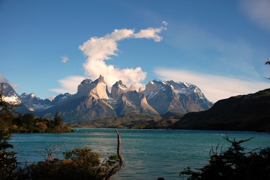
Torres del Paine to Tierra del Fuego by road, trail, and boat. The full length of the continent's wild edge.
Puerto Varas
The Carretera Austral starts at Puerto Montt, and Puerto Varas next door is the better place to spend the first night — a lake, two volcanoes and German bakeries left by nineteenth-century settlers. Buy what you need here: prices rise steadily for the next two thousand kilometres and choice falls faster than price.
Ferry into Pumalín
There is no road for the first stretch — the Andes come down to the sea and the route goes by ship. The ferry to Caleta Gonzalo or Chaitén crosses fjords with sea lions on the buoys, and lands you in Parque Pumalín, 400,000 hectares bought privately by Douglas Tompkins and handed to Chile in 2018.
Volcán Chaitén and the alerce
The volcano erupted without warning in 2008 after nine thousand years quiet, buried the town in ash and left a scorched forest of standing trunks you now climb through on a staircase trail. Elsewhere in the park, the alerce trail passes trees over three thousand years old.
Futaleufú
A detour east to the river that white-water rafters cross the world for — turquoise, glacier-fed and genuinely serious water. You do not have to raft it; the valley alone, with the Argentine border at the head of it, justifies the day.
The Queulat hanging glacier
Back on the Carretera and south into temperate rainforest. At Queulat a glacier sits in a hanging valley and spills two waterfalls off a cliff into the lagoon below it. The viewpoint trail is a steep hour through moss and nalca leaves the size of umbrellas.
Coyhaique
The only real town on the Carretera, and the place to fix whatever the road has broken, restock, and draw cash — ATMs south of here are unreliable and often empty. The Simpson valley reserve on the way in is a good short walk if you arrive with an afternoon spare.
Cerro Castillo
A basalt massif with a summit like a ruined fortress and a four-day traverse under it that many walkers rate above the Torres del Paine circuit. The day version climbs to Laguna Cerro Castillo, a glacial pool directly beneath the wall — six hours return and steep at the top.
The marble caves
Lago General Carrera is the second-largest lake in South America and an implausible blue. At Puerto Río Tranquilo, small boats run out to the Capillas de Mármol, where the water has cut swirled chambers into a marble headland. Go early — wind stops the boats by lunchtime more often than not.
The Exploradores valley, then Cochrane
A side road west runs to a viewpoint over the Exploradores glacier, one arm of the Northern Patagonian Ice Field. Then south again on gravel to Cochrane. The road surface deteriorates from here and vehicles start being judged by their spare tyres.
Patagonia National Park
The Chacabuco valley was an overgrazed sheep estancia until the fences came down and the grass came back. Guanaco herds are now dense enough that pumas hunt them in daylight, and the Lagunas Altas trail loops above the valley with the ice field on the horizon.
Villa O'Higgins
The end of the Carretera Austral — 1,240 km (770 mi) from Puerto Montt, and the road simply stops. A ferry across Lago O'Higgins is the only way onward, it runs a few times a week in season, and a missed sailing costs three days. Confirm it before you leave Cochrane.
The border on foot
One of the last crossings in the Americas without a road: a boat across the lake to Candelario Mansilla for the Chilean stamp, then 22 km (14 mi) on foot or by bike to Argentine immigration at Lago del Desierto, and a second boat. Cyclists push. Everyone arrives at El Chaltén exhausted and pleased with themselves.
Laguna de los Tres
The classic day under Fitz Roy: 20 km (12 mi) return with the last kilometre climbing four hundred metres of scree to a glacial lake directly below the granite. Start before dawn if you want the tower lit red, and turn back at the treeline if the wind is above about 50 km/h (31 mph).
Laguna Torre
An easier day — flat most of the way to a lake with icebergs in it and Cerro Torre behind, a spire that went unclimbed until 1974 and whose first ascent claim is still argued about. The Mirador Maestri viewpoint above the moraine adds an hour and is worth it in clear weather.
Perito Moreno
Three hours south to El Calafate and out to the glacier — a 5 km (3 mi) wall of ice 70 m (230 ft) high that is advancing rather than retreating, and calves into the channel loudly enough to make everyone on the walkways flinch. The boardwalk system takes a full afternoon at a proper pace.
Back into Chile
Five hours across the steppe to Puerto Natales through the Cerro Castillo border post, with guanacos and rheas on the fence line and almost nothing else. Natales is the staging town for Torres del Paine: rent gear, buy food, and confirm your park entry and refugio bookings tonight.
Base of the towers
The Base Torres trail is 18 km (11 mi) return with a final moraine scramble to the lake under the three granite spires. Weather here changes hourly and the last section is exposed; the classic dawn arrival requires camping at Chileno, which needs booking months out.
The French valley
The middle leg of the W: a catamaran across Lago Pehoé, then up into Valle del Francés between the Paine Grande glacier on one side and the Cuernos on the other. Avalanches come off the glacier face through the day, and you hear them before you find them.
Punta Arenas
South to the Strait of Magellan and a city built on wool and shipping before the Panama Canal took its traffic away. The cemetery, with its cypress avenues and immigrant mausoleums, is the strangest and best thing in town. Boats run to the Magdalena island penguin colony from November to March.
Crossing to Tierra del Fuego
The ferry over the Primera Angostura narrows takes twenty minutes and usually has Commerson's dolphins alongside. Then Argentine immigration again, the long flat run through Río Grande, and the road finally turning into the mountains at Tolhuin.
Ushuaia
The road ends in a town wedged between the Beagle Channel and snow-covered peaks, and the sign at Tierra del Fuego National Park marks the southern terminus of the Pan-American. A boat out to the Les Éclaireurs lighthouse, or the Martial glacier behind town, and that is the continent finished.
Good to know
This is a north-to-south route for one reason: the Villa O'Higgins crossing. The boats run only in the southern summer, roughly November to March, a few times a week, and weather cancels them. If that leg fails you can still reach El Chaltén by backtracking to Argentina at Chile Chico, but it costs two or three days — carry the slack.
Book Torres del Paine before anything else. Park entry is capped, and the refugios and campsites on the W and O circuits sell out months in advance; without a confirmed bed you will not be allowed onto the trail.
Wind, not cold, is the difficulty. Summer gusts on the exposed sections regularly pass 100 km/h (62 mph), which is enough to stop a walker and to close the ferries. Everything on this route is weather-dependent and nothing here is worth pushing through bad weather for.
Buses cover the whole route and are comfortable, but the Carretera Austral half runs on limited schedules — some sections have one departure a day and none on Sundays. Hitching is normal and safe on that stretch; a rented vehicle collected in Coyhaique and returned there is the flexible middle option.
Shorter or longer?
The southern half only: El Chaltén, El Calafate and Torres del Paine, flying into El Calafate and out of Punta Arenas.
Carretera Austral only, Puerto Montt to Villa O'Higgins and back to Coyhaique, without the Argentine leg or Tierra del Fuego.
Add the O circuit in Torres del Paine, the Chilean Lake District before Puerto Montt, and the Atlantic side — Península Valdés for right whales — after Ushuaia.