Kruger is about 350 kilometres long and most visitors see the bottom fifty. This drives the whole of it — down off the Mpumalanga escarpment at Phabeni, then north through Skukuza, Satara, Letaba and Shingwedzi into the sandveld at Punda Maria and on to the triangle beyond it, where the Luvuvhu meets the Limpopo and the land has belonged to the Makuleke community since 1998.
Johannesburg, and the clause
Constitution Hill is a fort, three prisons and a Constitutional Court on one hillside in Braamfontein. Gandhi and Mandela were held here in different decades and different blocks; Winnie Madikizela-Mandela and Albertina Sisulu were held in the Women's Jail. The court opened in 2004, built partly from the bricks of the awaiting-trial block that was demolished to make room for it, and section 25 of the constitution it interprets is the property clause — which is where the land restitution programme this route ends in comes from. The Apartheid Museum in the afternoon if there is anything left in you.
Up the Highveld and over Long Tom
The N4 east through eMalahleni — Witbank until 2006, and the middle of the coalfield that fires most of South Africa's electricity, with the cooling towers visible off the road on both sides — then Belfast, then off the N4 onto the R540 for Dullstroom, which sits just over 2,000 metres and is the country's trout industry in one street. Through Lydenburg, now Mashishing, and over the Long Tom Pass — named for the Creusot siege guns the Boer commandos hauled onto this ridge in 1900 and fired down the valley from it. Into the pine plantations at Sabie and up again to Graskop on the lip of the escarpment.
The Blyde River Canyon
North on the R532 to Bourke's Luck Potholes, where the Treur drops into the Blyde and the grit it carries has drilled cylinders into the rock, then on to the Three Rondavels, where the canyon runs about 700 metres deep in red quartzite. Back south for God's Window and for Pilgrim's Rest, a gold camp of 1873 that the provincial administration bought whole in 1972 and has kept as it was — a stranger form of preservation than it looks, and worth twenty minutes of thinking about.
Phabeni Gate and Skukuza
Down the escarpment through Hazyview and in at Phabeni, the newest of the southern gates. From there it is 45 kilometres of tar to Skukuza at a 50 km/h limit, which takes most of the morning if you drive it properly. Skukuza is the park headquarters and its largest camp, and it carries the name people in the district gave James Stevenson-Hamilton, warden from 1902 — generally translated as the one who sweeps clean, for what he did to the settlements inside his boundary. The park has stopped pretending that is a compliment.
The Sabie River
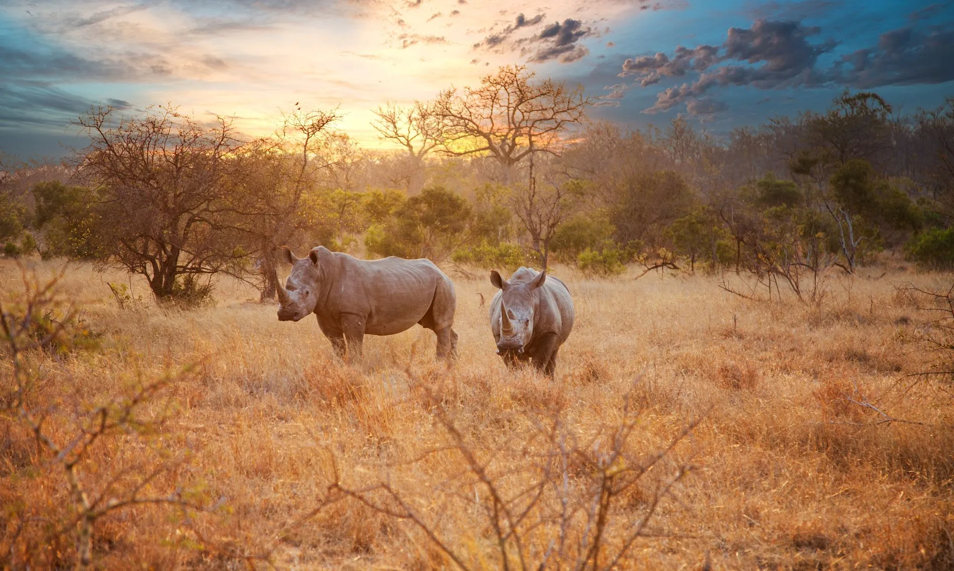
East on the H4-1, which follows the Sabie down to Lower Sabie and is the busiest road in Kruger because it is also the best: permanent water, big herds through the dry months, and lion on the sand more days than not. Sunset Dam at the far end, then the river loops on the way back. This southern section between the Sabie and the Crocodile is also where most of Kruger's rhino lived and where most of them were killed: the park counted more than ten thousand white rhino around 2011 and roughly two thousand a decade on, and a good share of the survivors have now been dehorned. Rangers do not put sightings out over the radio and the park asks visitors not to either — if you see one, do not post the photograph with a location attached to it. If you take one guided activity on this trip, take the night drive from Skukuza — you may not be outside a camp after gate closing in your own vehicle, and the hours after dark are where the park keeps everything the day does not show.
North to Satara
Ninety-three kilometres and the better part of four hours, because the limit is 50 and you will stop. The H1-2 crosses the Sabie and climbs onto the basalt plains and the country opens out — knobthorn and marula on black soil, which is why this is the grazing end of the park and why it carries the densest lion population in it. Tshokwane picnic site is roughly halfway and cooks breakfast on a griddle under the trees.
The S100 and the Nwanetsi
East out of Satara onto the S100, a gravel road along the Nwanetsi that has a reputation and mostly earns it, with the Sweni and Gudzani roads closing the loop. Out at first light, back by mid-morning, out again at four. This is the day to stop at a waterhole and stay there for an hour instead of driving — everything is walking to the water and you will not beat it there by covering ground.
Olifants and Letaba
North on the H1-4 and out along the spur to Olifants, which stands on a cliff above the river and has the best-sited terrace of any rest camp in the country. On to Letaba in the afternoon, where the Elephant Hall holds the tusks of six of the seven bulls the park named in 1980 — João's were broken off before he died in 1984 and never found — and does not dodge the awkward part: Kruger culled elephants from 1967 until 1994 to hold the population near seven thousand, then stopped, and the argument about what to do instead has never been settled.
Into the mopane
The vegetation changes here and stays changed. From Letaba north it is mopane — one tree, butterfly leaves, a hundred kilometres of it — which most visitors find monotonous and which is exactly why the northern half of the park has no traffic in it. Mopani camp sits above the Pioneer Dam; Shingwedzi is on the river of the same name, and the loop along that river is the reason to be here rather than the camp.
Punda Maria and the sandveld
Seventy-one kilometres and close to three hours. Punda Maria stands on sandstone rather than basalt and the botany turns over completely — sandveld, ironwood, more plant species than anywhere else in Kruger, and a bird list that pulls people the whole length of the park to see it. The camp is small and thatched, built in 1933 and still recognisably that. SANParks runs its own guided tour up to Thulamela from here, which is how you see the site if you are not going on to the concession — ask at reception whether it is running. If you are going on, the Makuleke walk covers Thulamela and there is no reason to pay for both.
The Luvuvhu and Crooks' Corner
North across the Luvuvhu bridge into the Pafuri triangle, a small fraction of Kruger's area holding a startling share of its bird list. Fever trees run in pale green stands along the floodplain, nyala and bushbuck under them, and at the end of the public road a survey beacon marks Crooks' Corner, where the Luvuvhu joins the Limpopo and South Africa, Zimbabwe and Mozambique meet with them. The name is literal. Ivory men and labour recruiters worked this spot in the 1900s because stepping over a river changed which police could arrest you.
Walking the Makuleke
Everything north of the Luvuvhu belongs to the Makuleke community, and the way to see it is on foot behind armed guides. Walking is not the rare part — SANParks sells three-hour morning walks at every main camp and runs multi-day wilderness trails besides. The rare part is being on foot all day in a block that has no public roads in it and no other vehicles. Up to the rim of Lanner Gorge, where the river has cut more than 150 metres into sandstone; out onto the Limpopo floodplain and its pans, which the wet season fills and the dry season turns into the reason everything is here; and up to Thulamela, a stone-walled hilltop town lived in for several centuries, abandoned around 1700, and excavated and partly rebuilt by the park's archaeologists in the 1990s.
Out through Ntlhaveni
Out at Punda Maria Gate and west on the R524. Within ten minutes you are among the Ntlhaveni blocks and Mhinga, villages that sit hard against the park fence and that are where the Makuleke were put down in 1969 when the state took the triangle you spent yesterday walking. They were not moved far — the boundary is in sight from the road — but they were moved about fifty kilometres from the two rivers, onto thin soil with no perennial water, and that was the point of it. Then Thohoyandou, the climb over the Soutpansberg, and Makhado, from where it is 440 kilometres of N1 back to Johannesburg in the morning.
Good to know
This is one of the few long safari routes in Africa an ordinary competent driver can do alone in an ordinary hire car: the spine of Kruger is tarred from Phabeni to Pafuri, every main camp has fuel and a shop, and the gravel loops are graded. The real discipline is administrative. Conservation fees are per person per calendar day and for the 2026 tariff year — SANParks runs them from 1 November to 31 October — the international adult rate in Kruger is R602 a day, plus a one per cent community levy and a booking fee on day-visitor slots reserved online. An international couple's all-parks Wild Card was R6,495 for twelve months, so on a trip with eight or nine nights inside the park it pays for itself somewhere around the sixth day; buy it before you arrive rather than arguing about it at the gate. It is a SANParks card and nothing more: Bourke's Luck Potholes and the Three Rondavels sit in a Mpumalanga provincial reserve and charge their own small entry at each gate, in cash more often than not. Camp accommodation is the binding constraint, not the fee: SANParks opens bookings eleven months ahead and Skukuza, Satara, Letaba and Punda Maria go within days for June to August and for the South African school holidays. Gate and camp opening times are seasonal, roughly 05:30 to 18:30 in midsummer and 06:00 to 17:30 in winter, they are printed on your permit, and being outside a camp after closing is a fine rather than a conversation. Limits are 50 km/h on tar and 40 on gravel, and you may not leave the vehicle except at camps, picnic sites, bird hides and the handful of signed get-out points — Mathekenyane and Nkumbe in the south, Red Rocks and Tshanga further north — which are marked on the park map and nowhere else. The Makuleke concession north of the Luvuvhu cannot be self-driven: public roads stop at Pafuri picnic site and Crooks' Corner, and the tracks beyond are used by the concession's own vehicles and its walking trails, booked through its operators, who meet guests at Pafuri Gate. Its full-board tented camp costs several times a SANParks bungalow; the self-catering bush house on the same concession does not, and is the version this budget assumes. The whole Lowveld is a malaria area and the Pafuri end is the highest-risk corner of it — transmission runs roughly September to May and peaks after the rains from January to April, prophylaxis is the standard advice for the far north in any month, and repellent plus long sleeves from late afternoon is not optional anywhere on this route. A yellow fever certificate is required only if you are arriving from, or have spent more than twelve hours in, a country with risk of transmission: a direct flight from Europe does not trigger it, a connection through Nairobi, Addis Ababa or Lusaka can. Season cuts both ways here — the south is at its best for game between May and September, when the grass is down and the animals are tied to water, while the north is at its richest in the summer for birds and flowering, which is also when malaria peaks and when heavy rain on the Luvuvhu can close the Pafuri road for days. Drive on the left, fill up at every main camp rather than the next one, and expect fuel stations outside the park to be attended. Last, read where this ends: the thirteenth night is in Makhado, not Johannesburg. The 440 kilometres of N1 back to the airport is a fourteenth morning, and the hire car has to be booked for it.
Shorter or longer?
The border post between Letaba and Mopani opened in 2006 as part of the Great Limpopo Transfrontier Park and crosses into Mozambique's Limpopo National Park — four or five more days on sand to Massingir and out to the coast. It needs 4WD and clearance, and it needs the vehicle paperwork sorted first: most South African rental contracts forbid taking the car into Mozambique at all, and the companies that allow it want a letter of authority in the glovebox, cross-border fees, and third-party insurance bought at the post. The gate keeps shorter hours than the park gates do, and it has closed for stretches — check it is open before you plan around it.
Johannesburg, the escarpment, Phabeni, Skukuza, Satara and Olifants, out at Phalaborwa. Keeps the best game viewing and the shortest driving days, and cuts Shingwedzi, Punda Maria and the Makuleke — which is to say it cuts the reason this route exists.