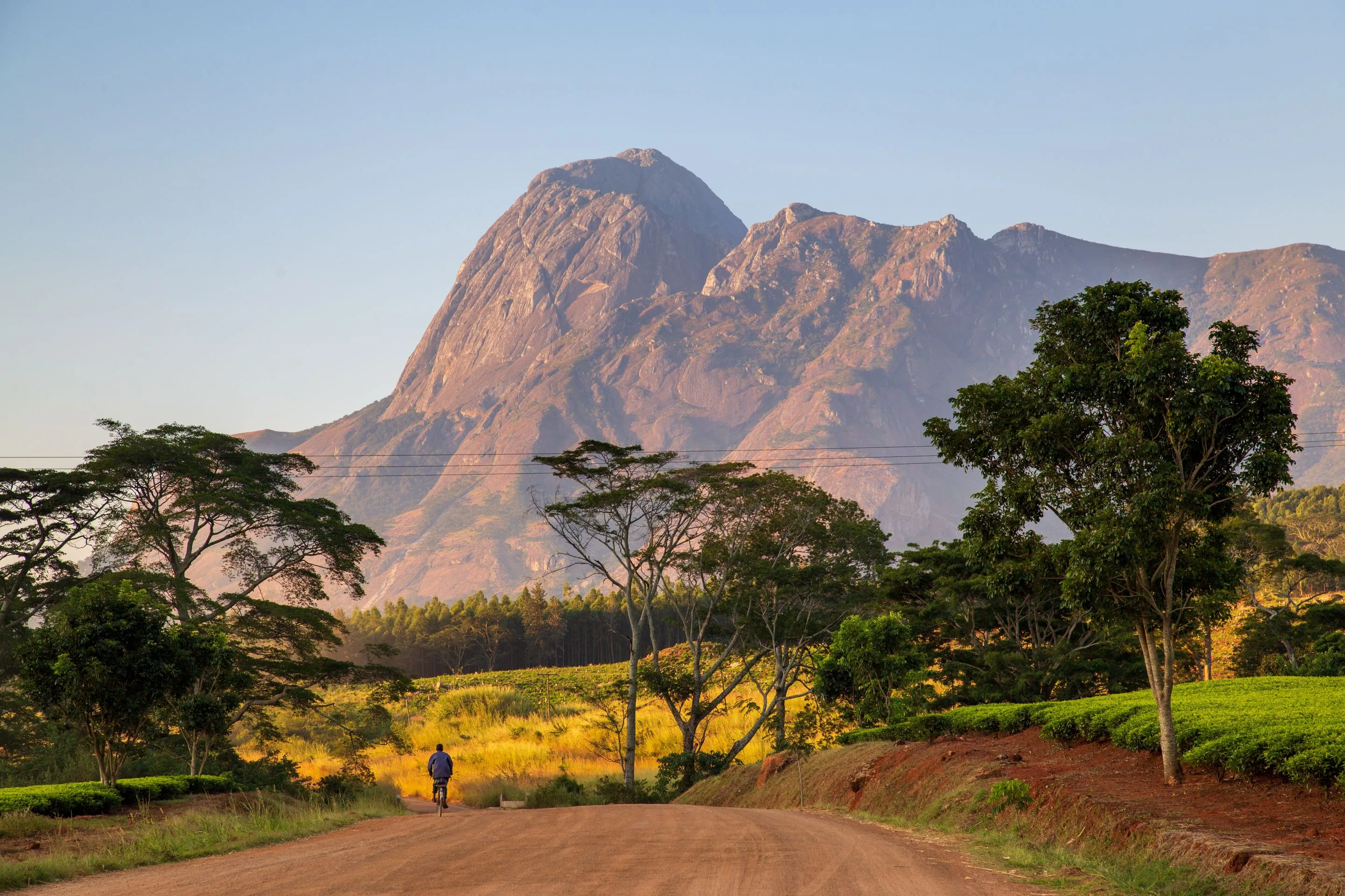
Down the Dedza escarpment to the southern end of Lake Malawi, then south through the Shire valley into the highlands — rock-art sites the Chewa still use, a bay full of fish that exist nowhere else, the river where five hundred elephants were loaded onto lorries, a massif that tops out at three thousand metres, two kilometres above the tea, and the reserve that was poached to nothing and then refilled.
Lilongwe
Arrive, buy a SIM, collect the vehicle and give the day to the city instead of driving out of it. Lilongwe is two towns with four kilometres of trees between them: Old Town, where the market, the bus depot and most of the eating is, and Capital Hill, the government quarter laid out from scratch after the capital was moved here from Zomba in 1975. The Lilongwe Wildlife Centre in the middle of it is a rescue sanctuary rather than a zoo and runs the wildlife-crime casework that put Malawi's first serious ivory sentences on the record. Change money and draw cash today — it gets harder as you go south.
Dedza and the Chongoni hills
Ninety minutes south on the M1 and then off it onto red dirt. The Chongoni Rock Art Area holds 127 recorded sites across the granite hills — the densest concentration in Central Africa — and it is unusual among rock-art landscapes because the tradition never stopped. The oldest schematic work is attributed to BaTwa hunter-gatherers; the later red and white figures belong to the Chewa, and Nyau, the masked society that made them, still uses several of the shelters. A guide from the Chongoni office at Mtakataka takes you to Chentcherere or Namzeze. Afterwards, Dedza Pottery is where every lodge in the country buys its plates.
Down the escarpment to Cape Maclear
The road drops off the plateau at Golomoti in a set of switchbacks with the lake laid out below, then runs south along the shore to Monkey Bay. The last eighteen kilometres to Chembe are dirt over a ridge and take longer than the distance suggests. Chembe is a fishing village of more than ten thousand people inside a national park, which is the whole argument of the place: nets drying on the beach at one end, dive boats at the other, and a park authority trying to referee. Swim in the afternoon and read the note on bilharzia before you do.
Lake Malawi National Park
Gazetted in 1980 and inscribed by UNESCO in 1984, this was the first national park anywhere created to protect freshwater fish. The lake holds several hundred cichlid species and the great majority are found in it and nowhere else; the rock-dwelling mbuna go further, with populations confined to single headlands, because a fish that will not cross open sand is effectively on an island. Take a boat to Thumbi West and Otter Point with a guide from the park office — mask and snorkel, no tank needed, the fish are in three metres of water. Fish eagles are fed for visitors off Thumbi and you can decide for yourself what you think of that.
South to Liwonde
Back over the ridge to Monkey Bay, then south down the lake's eastern arm to Mangochi, where the Shire river leaves the lake, then south on the M3. Mangochi is worth twenty minutes for the Lake Malawi Museum and the clock tower put up for Queen Victoria in a town that was called Fort Johnston when the gunboats were based here. Liwonde's main gate is at Chikolongo; Mvuu Camp is another forty minutes inside on sand tracks, and the last part of the approach can be done by boat if the river is high.
The Shire
Out on the river at six. Liwonde is narrow — a strip of park either side of the Shire — and that concentration is why the boat is better than the vehicle here: hippo in numbers, crocodile on every sandbank, elephant coming down to drink, and something over four hundred bird species recorded. African Parks has run it under a delegated-management agreement with the government since 2015, and the perimeter fence, the cheetah brought back in 2017 and the lions in 2018 all date from that; the fenced rhino sanctuary inside the park is older, put up in 1993. It is also the park most of the 520 elephants of the 500 Elephants operation came out of — it was overstocked, the trees showed it, and the animals went north to Nkhotakota rather than being culled. Ask, and the guides will tell you exactly what they think of the maths.
Up to Zomba Plateau
A short drive and thirteen hundred metres of climb. Zomba was the capital of Nyasaland and then of Malawi until 1975, and Parliament went on sitting here until 1994, which is why a small town in the hills has a State House, a colonial secretariat and an avenue of jacarandas. The plateau above it is a syenite block whose surface sits around 1,800 metres, topping out at Malumbe at 2,087, cut by the Mulunguzi stream and planted with pine and eucalyptus over most of its top. Drive or walk up the old road to Chingwe's Hole and the Emperor's View, and stop at the Trout Farm. It is cold up there after dark, which comes as a surprise.
To Likhubula, under Mulanje
South through Chiradzulu to Limbe, then east on the M2 through the tea estates of Thyolo and Mulanje, and the massif appears an hour before you reach it. Sapitwa, its high point, is 3,002 metres, and the mountain stands more than two kilometres above the plain with nothing between. Sort the walk this afternoon at the forestry office at Likhubula: guides and porters are registered and priced there, and you want both, less for the load than because the paths fork constantly. Walk to the Dziwe la Nkhalamba pools in what is left of the day. The scars on the lower slopes are from Cyclone Freddy in March 2023, which killed more than a thousand people in this district and the two next to it.
The Chambe basin
Up the Chambe plateau path, which climbs about 1,200 metres in roughly four hours and is a hard, honest walk rather than a technical one. The basin at the top is grassland at around 1,900 metres with the Chambe rock face standing over it — the longest continuous rock climb in Africa, if that is your subject. What you are looking for on the way is the Mulanje cedar, Malawi's national tree, which grows on this massif and on no other mountain on earth; illegal logging and fire took almost all the mature stands, and the replanting nurseries you pass on the path are the response. Down the same way, or sleep at Chambe hut and come off in the morning.
West to Blantyre
Two hours through the tea and into the commercial capital. Blantyre was named by Scottish missionaries after the village Livingstone was born in and is the oldest town in the country: Mandala House went up in 1882 and is the oldest building still standing in Malawi, now a library and a café. St Michael and All Angels was built between 1888 and 1891 by a missionary with no architectural training and no engineer, out of bricks fired on site, and it is still standing too. The Museum of Malawi at Chichiri is the national collection. Then climb Michiru or Ndirande in the late afternoon for the shape of the city.
Into Majete
West down the Shire valley to the lower river, the last twenty-five kilometres on dirt. Majete is the argument this whole route ends on. By the early 1990s it had been shot out — no elephant left, no rhino, and the surrounding villages using it as a woodlot. African Parks took over its management in 2003, in its first agreement anywhere, and has since moved in several thousand animals: black rhino that year, elephant, buffalo, and lion in 2012. Take an afternoon drive and note that the fence is the point and that it cost somebody something.
The river, and out
A last drive at first light down to the Mkulumadzi and Shire confluence, then out through Chikwawa. Blantyre and Chileka airport are two hours away, which works if you are flying regionally to Johannesburg, Nairobi or Addis. Kamuzu International at Lilongwe, which is where most long-haul connections are, is a different proposition: 310 kilometres beyond Blantyre, five hours on the M1 through Balaka and Ntcheu, which with the drive out of the reserve makes a whole day and rules out combining it with a morning game drive. Malawi Airlines flies the Blantyre–Lilongwe hop in about fifty minutes when the schedule is running, and if you have hired a vehicle you need to have agreed the one-way drop fee before you book the seat.
Good to know
Check the visa position the week you book, because it has moved twice in two years. Malawi waived visas for nationals of 79 countries in 2024 and then narrowed that list again in early 2026, putting most western European, North American and British travellers back inside the visa system. The mechanism now is the e-visa at evisa.gov.mw — a single-entry tourist visa is around US$50 for 30 days, and although some nationalities can still be issued one at the airport, the government asks you to apply in advance and airlines increasingly check for it at the gate. SADC nationals continue to enter without one. A yellow fever certificate is demanded only of arrivals from countries with a risk of transmission, not of everyone; Malawi itself is not a risk country. Malaria is the serious medical question and there is no altitude on this route high enough to escape it — transmission is year-round and countrywide, the lakeshore and the Shire valley are the worst of it, and every travel clinic will prescribe prophylaxis for the full twelve days. Bilharzia is in Lake Malawi, including at Cape Maclear. The risk is lower in deep, wave-washed water off rocky points than in warm shallows near a village, but it is not zero anywhere, and the standard advice is to swim if you want to and then take praziquantel six to eight weeks later — a cheap tablet and a routine part of leaving this country. The practical problem you will actually spend time on is fuel. Malawi has been short of foreign exchange for several years, the kwacha was devalued sharply in 2023 and again since, and importing fuel requires dollars the central bank has not reliably had; rationing, dry pumps and long queues have been recurrent through 2025 and 2026, and the Reserve Bank was still describing forex supply as subdued relative to demand in May 2026. Plan the trip around it: fill up whenever you pass a station with fuel rather than when the gauge tells you to, carry a jerrycan, and treat Lilongwe and Blantyre as the only places you can count on. Cash follows the same logic. Cards work in city hotels and almost nowhere else, ATM withdrawal limits are low and machines run empty, and clean, large-denomination US dollar notes are the thing to carry and change at a bank or a licensed bureau rather than at a border — worn or small notes get a visibly worse rate. Roads: the M1 spine and the M3 to Mangochi are tarred and mostly decent, with potholed stretches that appear without warning; the approaches to Cape Maclear, Majete and the Mulanje trailheads are dirt and want clearance. Self-drive is genuinely realistic here and most visitors do it. Drive on the left, carry your national licence and an International Driving Permit, and do not drive after dark — unlit vehicles, bicycles without reflectors, goats and people on the carriageway make night driving the single largest risk on the trip. The rains run roughly December to March and turn the dirt sections and the Majete tracks to grease; Cyclone Freddy in March 2023 killed over a thousand people in the Blantyre, Chiradzulu, Mulanje and Phalombe districts and washed out bridges that took years to replace, so ask locally rather than trusting a map after heavy rain. On Mulanje, the weather is the hazard: chiperoni, a cold wet mist driven up from the south-east, can close the plateau in an hour at any time of year, and walkers have died of exposure on a mountain that sits at sixteen degrees south. Take the registered guide, carry warm layers and a head torch, and tell the forestry office your route. Fees are paid in dollars or kwacha at the gate — expect roughly US$30 to US$40 per person per day at Liwonde and Majete plus a vehicle charge, around US$10 at Lake Malawi National Park, and a modest forestry fee at Mulanje on top of the guide and porter day rates set at Likhubula.
Shorter or longer?
Add five or six days from Lilongwe instead of flying out: Nkhotakota, the reserve 520 elephants were moved into, then Nkhata Bay, the Livingstonia escarpment where the mission relocated in 1894 to get above the malaria line, and the Nyika Plateau at 2,000 metres, which is rolling grassland with roan and eland on it and nothing else in southern Africa that looks like it. The MV Ilala, on the lake since 1951, can in principle do part of this for you, but sailings have been suspended for long stretches in recent years — treat it as a bonus and never as a booked connection.
Fly into Blantyre and run Majete, Liwonde, Zomba and Mulanje as a loop. Keeps the two reserves and the massif and cuts the lake, Chongoni and every long transfer — which is also most of the fuel.