Majuro, Arno and the Old Capital
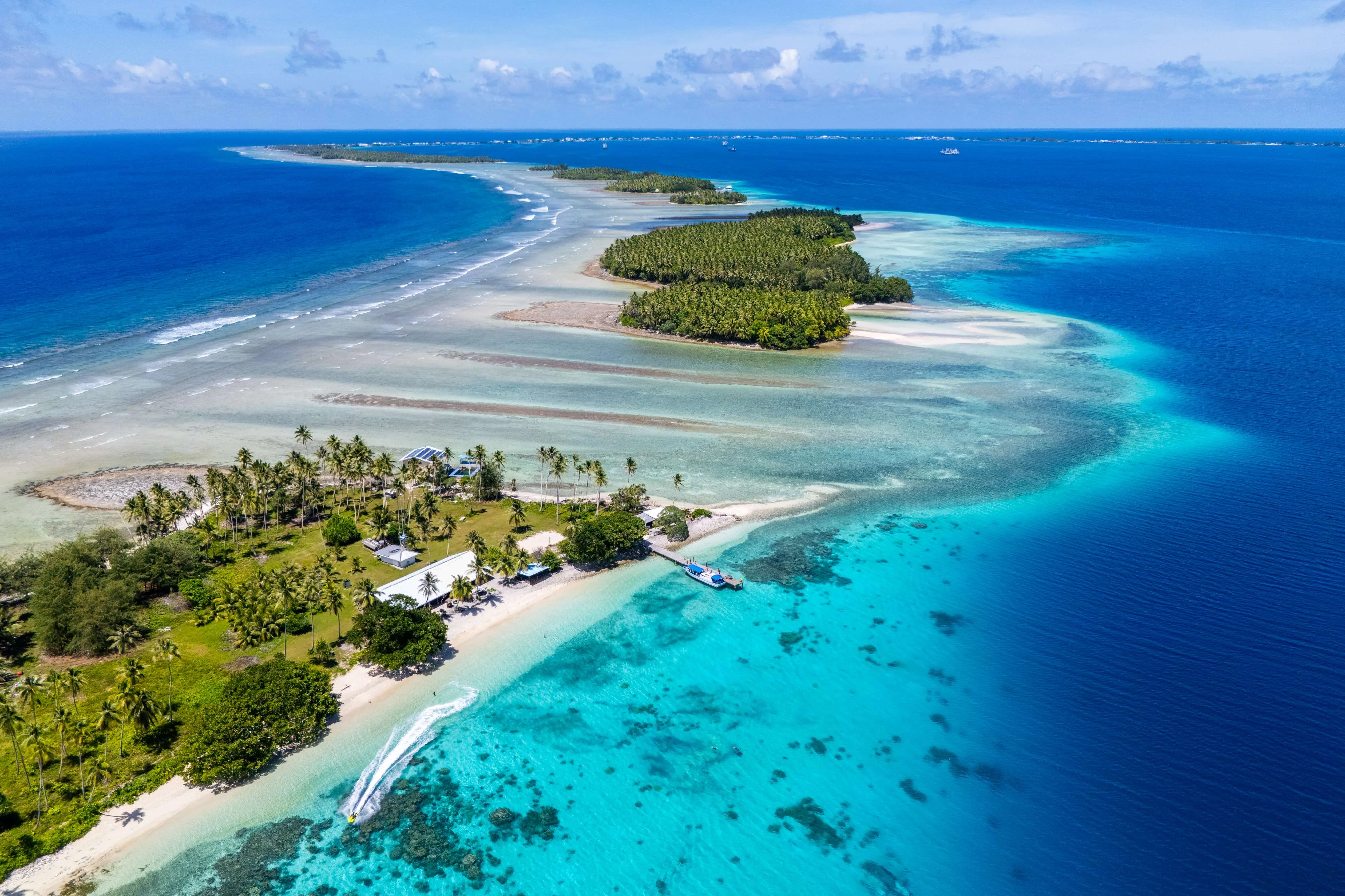
Three atolls out of twenty-nine, in the eight days the domestic schedule actually allows: the ribbon of Majuro where more than half the country lives, an open boat across the channel to Arno, and Air Marshall Islands down to Jaluit, which Germany and then Japan governed these islands from and a typhoon finished off in 1958. Nothing here runs daily. The route is built around the flight days rather than the other way round.
Majuro: the strip
Delap, Uliga and Djarrit run into one another along a road with the lagoon on one side and the open Pacific on the other, and in places you can see both from the same spot. The Alele Museum in Uliga holds the stick charts — mattang for teaching, meddo for a section of the chain, rebbelib for the whole of it — which are not maps of islands but records of how swells bend around them. The Nitijela sits in Delap. Behind it, the Tobolar plant buys copra from every atoll in the country at a price the government sets, which is the entire cash economy of the outer islands in one shed.
West to Laura
The road runs about fifty kilometres (31 miles) from Rita at the eastern tip to Laura at the western, and shared taxis do the whole length for a few dollars, stopping wherever you wave. Past the airport the urban strip thins out into breadfruit, pandanus and household graves. Laura sits on the widest ground the atoll has, wide enough to hold a lens of fresh water under it — which is why things grow there, why Majuro's water arguments are about this end of the island, and why the beach at the end of the road is the one everybody drives out to on a Sunday.
The lagoon and Calalin Channel
Majuro's lagoon is around 295 square kilometres of water inside a rim you can drive along, and the dive boats run north to Calalin Channel, the pass where the flood tide pours in and grey reef sharks sit in the current without appearing to work at it. American forces took Majuro on 31 January 1944 and found it undefended, then used it as a fleet anchorage for the rest of the Pacific war, so what lies on the bottom here is aircraft and small craft rather than the capital ships at Bikini. If the wind is up, take a boat to one of the northern islets instead and swim off it.
Across the channel to Arno
Arno is fifteen kilometres (9 miles) east of Majuro's tip across open water and there is no ferry, no schedule and no timetable to consult — you arrange an outboard boat and a return day, and in a swell it does not go at all. Under two thousand people live on the atoll, mostly at the western end, and the copra they cut goes back across the channel to the plant you saw in Delap. Land here belongs to somebody under the iroij, alap and rijerbal system, so the afternoon is spent being introduced rather than exploring.
Longar, and the boat back
The long north-eastern arm of the atoll runs out to Longar Point, where the reef drops away close enough to the beach that yellowfin and marlin are taken within sight of it, and the fishing here is the reason most outsiders have heard of Arno at all. Walk what you are shown and no more; nothing on this atoll is public land, and the difference between a path and somebody's garden is not signposted. Back across the channel in the afternoon, before the trades get up.
Down to Jaluit
An hour south-west by Dash 8 into the Ralik chain, and a different century. Germany declared a protectorate over the Marshalls in 1885 and ran them from Jabor on Jaluit; Japan took the islands in 1914 and administered its Marshalls district from the same town until the war. Concrete foundations, a wharf and a cemetery are what is left above ground. On 7 and 8 January 1958 Typhoon Ophelia crossed the atoll and destroyed almost every building on it, and Jaluit — which had already lost the administration to Majuro — never came back as a town.
Imiej and the lagoon
A boat across to Imiej, where the Japanese built a seaplane base: ramps into the water, a power station, gun positions and hospital foundations, all of it being taken apart by roots and salt at a speed that surprises people who have seen European ruins. Jaluit is the country's only Ramsar-listed wetland, entered on the list in 2004, and the lagoon is the point of the designation — one of the largest in the southern Marshalls, with seabird colonies on islets nobody lives on. Fish with whoever is going out in the afternoon.
Back to Majuro, and out
The flight north, then the last of the capital. The field-trip ships load at the dock in Delap — rice and fuel out, copra and passengers back — and watching one being worked explains the geography of this country better than any map. Buy a jaki-ed at the handicraft shop if there is one to buy: the fine woven mat almost died out and has been brought back deliberately over the last twenty years, and the good ones are commissioned rather than stocked. The island hopper leaves from Amata Kabua International and it does not leave every day, which is why the Jaluit return is booked with days in hand rather than against the connection — if the aircraft does not come, you want the slack sitting here rather than in Jabor.
Good to know
Getting in is the first constraint and it does not bend. United's island hopper runs Honolulu–Majuro–Kwajalein–Kosrae–Pohnpei–Chuuk–Guam and back a few days a week rather than daily, and Nauru Airlines comes up from Brisbane by way of Nauru and Tarawa on a weekly pattern that changes; there is no third way in for a passenger, and missing a connection here costs days rather than hours. Air Marshall Islands flies the outer atolls with a fleet you can count on one hand, and its published schedule is a statement of intent — cancellations are ordinary and an aircraft can be out of service for weeks. Book the Jaluit legs before anything else, keep two spare days in front of the international flight, and treat the government field-trip ships, which visit the outer atolls every few weeks on no timetable at all, as a fallback rather than a plan. The US dollar is the currency and this is a cash economy: banking and cash machines are effectively a Majuro and Ebeye matter, the two Majuro hotels take cards and very little else does, and you draw everything an outer atoll will need before you get on the plane rather than expecting to find a machine in Jabor. United States citizens enter without a visa under the Compact of Free Association, as do citizens of the Federated States of Micronesia and Palau; everyone else is issued an entry permit on arrival at Majuro, normally thirty days and extendable at immigration in Delap — there is no e-visa, no consulate at the airport and no way to argue a refusal, so confirm the current rules with immigration directly before booking. All land is customarily owned under the iroij, alap and rijerbal system and there is no public land in the Western sense: on Majuro that means asking before you walk off the road, and on an outer atoll it means presenting yourself to the alap or the council on arrival and going where you are taken. December to April is the drier, windier half under the north-east trades and gives the better boat weather; May to November is wetter. The Marshalls sit near the eastern edge of the typhoon belt, so a direct hit is rare rather than unknown — the one that flattened Jabor came through in January 1958 — but king tides wash across sections of the Majuro road most years, and the northern atolls live entirely on rainwater catchment, with national drought emergencies declared more than once this century. On an outer atoll the water is somebody's tank; use it as though it were. There is no malaria and dengue outbreaks do occur; hospital care exists on Majuro and Ebeye and nowhere else, and anything serious is a medical evacuation to Honolulu, so insurance with evacuation cover is not optional here. Kwajalein is a US Army installation and the impact zone for missiles launched from California — you cannot visit it, and reaching Ebeye beside it needs clearance arranged weeks ahead, because the only route there runs through the airfield on the base. Bikini has been a World Heritage site since 2010 and the target fleet sunk in its lagoon during Operation Crossroads in 1946 — the carrier Saratoga and the battleship Nagato among them — is the reason technical divers come at all; it is also served by charters that have been suspended for years at a stretch, so never build a trip around it without a confirmed operator. External radiation in that lagoon is low, but food grown on the northern atolls is not safe to eat, and that — not the diving — is why nobody lives there. Sunday is quiet and most things shut; dress modestly, and note that here it is thighs rather than shoulders that matter, so women swim in shorts and a T-shirt outside the hotels. Buy an NTA SIM in Majuro, where the submarine cable has made the capital properly connected, and assume nothing beyond it. Finally, 1 March is Nuclear Victims Remembrance Day and a public holiday: offices and shops close, and the testing programme is not a curiosity to raise lightly, because almost everyone you meet has a family connection to it.
Shorter or longer?
Three more days and the hardest permission in the country to obtain. Ebeye holds somewhere around nine or ten thousand people on roughly a third of a square kilometre, which makes it one of the densest inhabited places on earth, and much of its working population commutes by ferry to jobs on the US Army base next door. There is no airstrip on Ebeye: you land at Bucholz Army Airfield on Kwajalein and need clearance arranged weeks ahead through a sponsor simply to walk from the aircraft to the boat. Go only if the paperwork is genuinely in hand — none of it can be improvised at the gate.
The first three days plus a second lagoon day, and no domestic flight at all: the museum, the length of the atoll, Laura and the diving. You lose both outer atolls, which is to say you lose the country — but it is the right trip if your dates are pinned to the island hopper and you cannot absorb an Air Marshall Islands return that does not happen.