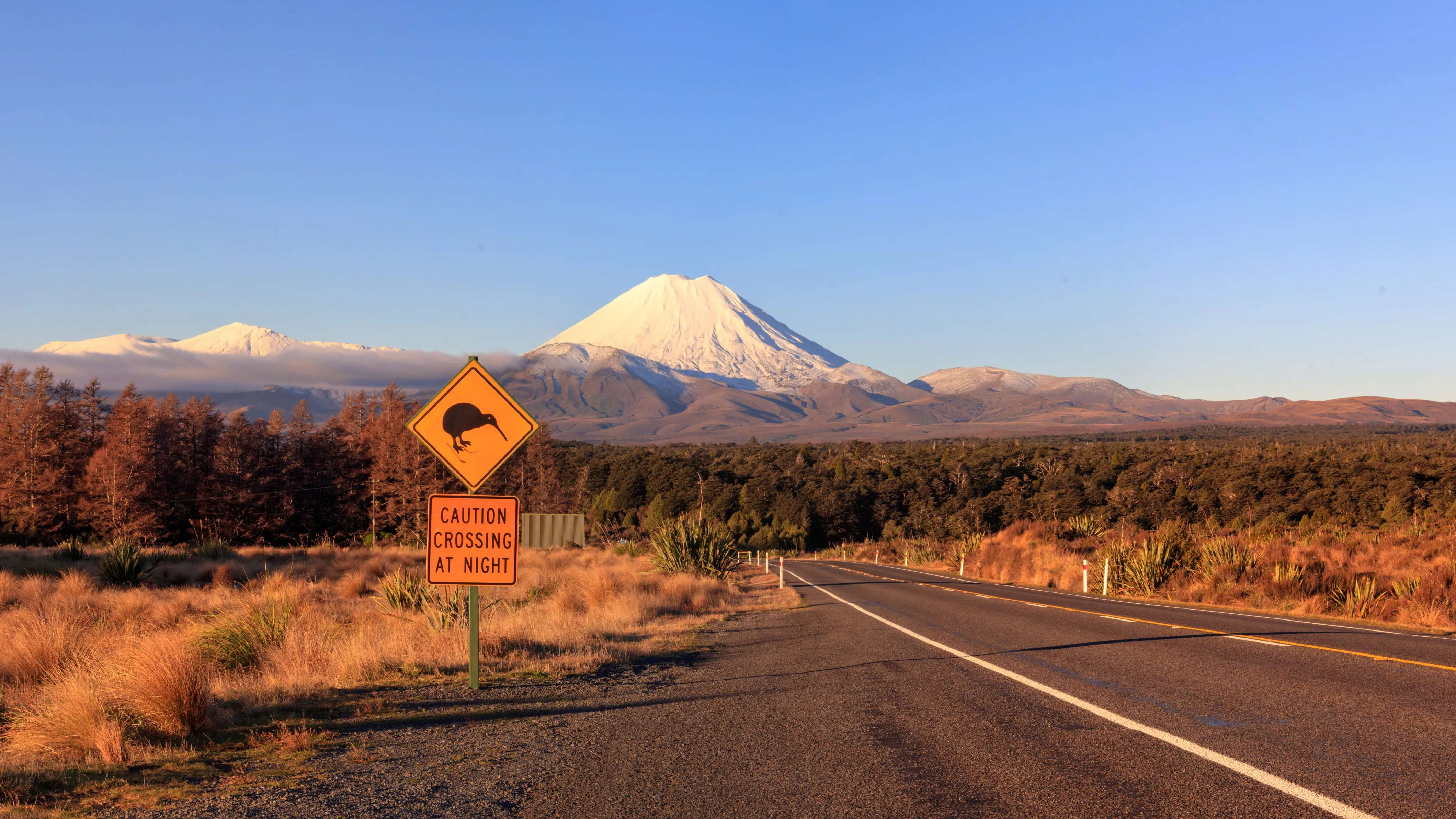
The North Island down its own spine — Auckland's dormant cones, the geothermal ground at Rotorua, the volcanic saddle at Tongariro, then the Whanganui from its headwaters to the Tasman, on a road with four marae on it. It ends in a fenced valley above Wellington cleared of every introduced mammal but the mouse, which found its own way back in, and in the city where a river was made a legal person in 2017.
Auckland
A city of 1.7 million built on top of about fifty volcanoes, which is not a metaphor — Maungawhau, Maungakiekie and North Head are eruption sites with terraces cut into them by Māori who fortified them centuries before the cones became parks. Climb one in the evening and the whole field is legible from the top.
Rangitoto
Twenty-five minutes across the harbour to the youngest volcano in the field, which came out of the sea about six hundred years ago and was watched from shore by people already living here. The summit walk is an hour up over bare scoria with pōhutukawa growing straight out of the lava. There is no water on the island and no shade worth the name.
South to Waitomo
Through the Waikato dairy country to the limestone. Tāne Tinorau and the surveyor Fred Mace went into the glowworm cave in 1887 and it has taken visitors since 1889; it was returned to Tinorau's descendants a century later and they take a share of the revenue. Numbers inside are governed by a carbon-dioxide reading, because a few hundred people exhaling in a closed chamber changes the chemistry the formations depend on.
Rotorua
East across the volcanic plateau to a town that smells of sulphur and does not apologise for it. Whakarewarewa is a working village on active ground: Tūhourangi Ngāti Wāhiao live there, cook in the boiling pools and bathe in them, and Pōhutu — the largest active geyser in the southern hemisphere — goes up behind the houses every twenty to sixty minutes, to thirty metres.
Tarawera and Wai-O-Tapu
On 10 June 1886 Mount Tarawera split open along seventeen kilometres, buried the village of Te Wairoa, destroyed the Pink and White Terraces and killed more than a hundred people; the survivors of Tūhourangi were resettled at Whakarewarewa, which is why the village is where it is. Wai-O-Tapu, south of town, has the Champagne Pool at about sixty-five metres across, and a geyser that is set off with detergent at 10.15 every morning — a piece of theatre the park is honest about.
Taupō
The lake is a caldera. The eruption that made it, about 25,500 years ago, is the largest known anywhere in the last seventy millennia, and a second one around the third century AD stripped the middle of the island. Pick up the hire car here; everything from now on is either a mountain road or a river road.
Whakapapa
Round the eastern shore and up to the village under Ruapehu. Horonuku Te Heuheu Tūkino IV gave these summits to the nation in 1887 to keep them out of settler hands, which made this the first national park in the country and the fourth in the world. On Christmas Eve 1953 a lahar out of Ruapehu's crater lake took the rail bridge at Tangiwai seconds before the Wellington–Auckland express reached it and 151 people died; the lake is now wired to an alarm system that worked as designed when it broke out again in 2007.
The Tongariro Alpine Crossing
Nineteen and a half kilometres over the saddle between Tongariro and Ngāuruhoe: boardwalk up the Mangatepōpō valley, a hard climb to Red Crater at just under 1,900 metres, then loose scree down past the Emerald Lakes, which are that colour because of dissolved minerals and are far too acidic to touch. The park was listed by UNESCO for its volcanoes in 1990 and again in 1993 as a cultural landscape — the first site in the world inscribed under those revised criteria.
Taumarunui and the headwaters
North-west down SH4 to the town where the Whanganui meets the Ōngarue and where canoes put in for the Whanganui Journey — the one Great Walk you paddle rather than walk, 145 kilometres and five days down to Pipiriki. The river runs 290 kilometres in all, from the slopes of Tongariro to the Tasman, and is the longest navigable one in the country. SH43, the Forgotten World Highway, runs west from here through Whangamōmona if you want a spare day.
Down to Pipiriki
South on SH4 to Raetihi and then west to the river. Jet boats run 32 kilometres upstream from Pipiriki to the Mangapurua landing, and it is forty minutes on foot from there to the bridge — concrete, opened in June 1936, standing in bush with no road to it, because the valley behind it was carved up for soldiers coming home from the First World War and the last families walked out in 1942, after a flood that January and a government decision in May not to repair the access. It is the clearest thing in the country about what land settlement schemes actually cost.
The River Road
Seventy-nine kilometres and most of a day, because the road is narrow and follows every bend. Hiruhārama — Jerusalem — has St Joseph's church, the order Suzanne Aubert founded in 1892, and the settlement where James K. Baxter ran his commune from 1969; he died in Auckland in October 1972 and was carried back here to be buried. Rānana, Kōriniti and Ātene are working marae, not exhibits: stop at the road, not in the courtyard. Whanganui by evening.
Whanganui, then the coast
Te Whare o Rehua Sarjeant Gallery reopened on 9 November 2024 after ten years shut for earthquake strengthening; the Lindauer portraits of Whanganui rangatira are not there but next door at the regional museum, which is the better hour of the two if you only have one. The Durie Hill elevator, opened in 1919, runs 213 metres into the hill and then 66 metres up it — the only public underground passenger lift in the country, and still ordinary transport for the people who live at the top. Drop the car, take the afternoon bus south.
Kāpiti Island
A nature reserve since 1897 and, after two decades of eradication work, free of mammalian predators since 1999. What that produces is audible before it is visible: about 1,200 little spotted kiwi, the stronghold of a bird every other surviving population was founded from, plus takahē, kōkako, hihi and saddleback at densities no unfenced forest holds. Fifteen minutes off Paraparaumu Beach and a different country.
Wellington
An hour down the electrified line. Zealandia is 225 hectares of valley behind an 8.6-kilometre fence built in 1999 to keep out everything from a stoat to a mouse — mice are the one species that found their way back in — and the kākā and kererū now loud across the whole city came out of it. Then Te Papa, free and enormous, and Parliament up the hill, where in March 2017 a river was made a person.
Good to know
Distances mislead here: the open-road limit is 100 km/h and very little of this route is driven at it, so add half again to whatever a map estimates. The Northern Explorer between Auckland and Wellington runs three days a week in each direction rather than daily, so a train leg fixes your dates instead of fitting them, and the Capital Connection into Wellington is a commuter service — south in the morning, north in the evening, weekdays only, nothing on public holidays. Book the Tongariro Alpine Crossing shuttle rather than driving to the trailhead, because both road-end car parks carry a four-hour limit and the walk takes seven or eight; treat the operator's weather call as final, since the exposed ground between Red Crater and the Blue Lake is where the rescues happen, and note that Ngāti Hikairo ki Tongariro ask visitors not to climb Ngāuruhoe or the summit cones. From roughly June to October the Crossing is not a walk but an alpine route — DOC is blunt about it: ice axe, crampons, helmet and the competence to use all three, or a guide who brings them — and a raised volcanic alert level on Ruapehu or Tongariro closes it outright whatever the forecast says. The Whanganui River Road is slow and slips after heavy rain: fill the tank at Raetihi, check the district council's road page before committing, and note that the mail van does the road as a real postal run, about eighty delivery stops, which is the cheapest guided version of that day — but it runs out of Whanganui in the morning and back, so it is a return day trip from the city rather than a one-way lift down from Pipiriki. Landing on Kāpiti Island is possible only on a permit issued through one of the two licensed operators out of Paraparaumu Beach, numbers are capped at 160 a day across the two landing points, summer dates go months ahead, and the crossing cancels in a southerly — this route gives you exactly one attempt at it, so take the earliest boat and know that the island is also a train-and-boat day trip out of Wellington if you have to go back for it. A one-way hire between depots, Taupō to Whanganui here, attracts a relocation fee that is worth asking about before you book. Border biosecurity is enforced rather than performative: undeclared food or muddy boots earn an on-the-spot infringement fee, and both the NZeTA and the International Visitor Conservation and Tourism Levy, raised to NZ$100 in October 2024, are paid before you fly.
Shorter or longer?
Interislander or Bluebridge from Wellington to Picton, three and a half hours over Cook Strait, then the Coastal Pacific down to Kaikōura and Christchurch. Seven to ten more days, and honestly a second trip rather than an extension of this one.
Auckland, Taupō, Whakapapa and the Crossing, Taumarunui, Pipiriki, the River Road and Whanganui, out through Palmerston North. Keeps the volcanoes and the whole river; drops Waitomo, Rotorua and Kāpiti Island.